
File:1863 map of Stony Brook drainage basin.jpg

Size of this preview: 473 × 600 pixels. Other resolutions: 189 × 240 pixels | 378 × 480 pixels | 605 × 768 pixels | 807 × 1,024 pixels | 1,614 × 2,048 pixels | 6,384 × 8,098 pixels.
Original file (6,384 × 8,098 pixels, file size: 10.94 MB, MIME type: image/jpeg)
| This is a file from the Wikimedia Commons. Information from its description page there is shown below. Commons is a freely licensed media file repository. You can help. |
Summary
| Description |
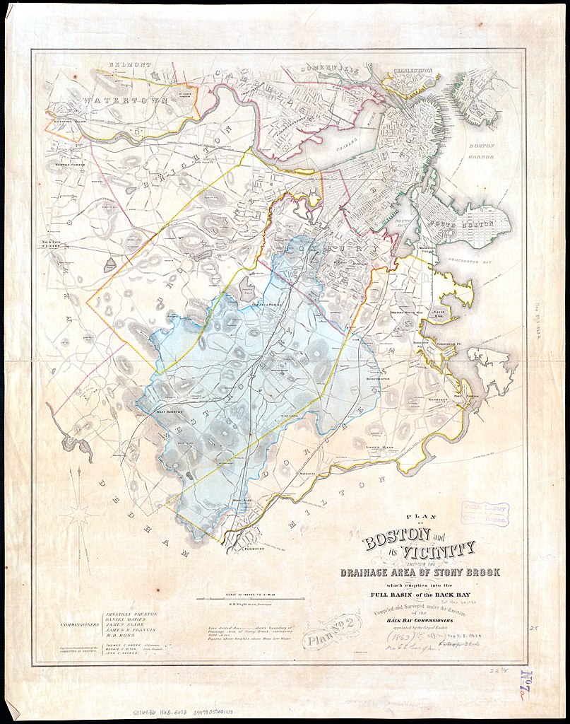
English: An 1863 map of the Stony Brook drainage basin. Over the next century, most of the Stony Brook and its tributaries were placed in culverts. |
|||
| Date | ||||
| Source | Norman B. Leventhal Map Center | |||
| Author | H. M. Wightman, surveyor | |||
| Permission (Reusing this file) |
|

File history
Click on a date/time to view the file as it appeared at that time.
| Date/Time | Thumbnail | Dimensions | User | Comment | |
|---|---|---|---|---|---|
| current | 05:54, 23 June 2020 | | 6,384 × 8,098 (10.94 MB) | Pi.1415926535 | restore colors |
| 05:53, 23 June 2020 |  | 6,384 × 8,098 (5.8 MB) | Pi.1415926535 | {{Information |description ={{en|1=An 1863 map of the Stony Brook drainage basin. Over the next century, most of the Stony Brook and its tributaries were placed in culverts.}} |date =1863 |source =[https://collections.leventhalmap.org/search/commonwealth:cj82m029n Norman B. Leventhal Map Center] |author =H. M. Wightman, surveyor |permission ={{PD-scan|PD-US-expired}} }} Category:Old maps of Boston from the Norman B. Leventhal Map Center [[Category:Other images... |
File usage
The following pages on the English Wikipedia use this file (pages on other projects are not listed):