
File:Lake Victoria vegetation map-fr.jpg
Size of this preview: 766 × 599 pixels. Other resolutions: 307 × 240 pixels | 613 × 480 pixels | 981 × 768 pixels | 1,150 × 900 pixels.
Original file (1,150 × 900 pixels, file size: 285 KB, MIME type: image/jpeg)
| This is a file from the Wikimedia Commons. Information from its description page there is shown below. Commons is a freely licensed media file repository. You can help. |
Summary
Forest
Savannah
Herbaceous
Desert
Highland
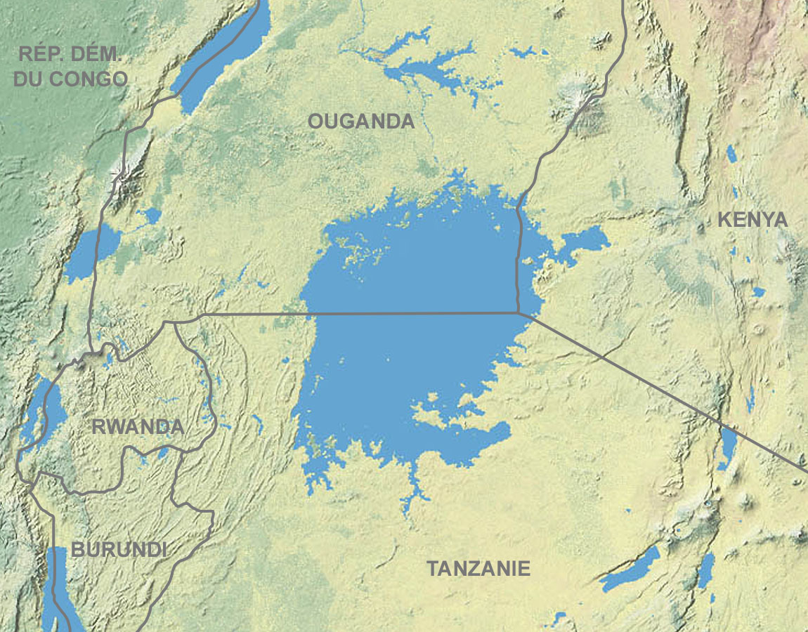
| Description | Map in French showing the vegetation of lake Victoria's area |
| Date | of the upload : December 2006 |
| Source | Map from Shadedrelief.com (cropped and modified) |
| Author | Tom Patterson, US National Park Service |
| Permission (Reusing this file) |
Public domain (terms of use) |
| Other versions | Blank : Image:Lake_Victoria_vegetation_map-blank.jpg |
Forêt
Savane
Plantes herbacées
Désert
Montagne
Français : * Sujet : Carte en français montrant la végétation de la région du lac Victoria ;
- Source : Carte de Shadedrelief.com (recadrée et modifiée) ;
- Auteur : Tom Patterson, US National Park Service ;
- Date du chargement : Décembre 2006.
- Autre version : vierge : Image:Lake_Victoria_vegetation_map-blank.jpg
Licensing
This work is in the public domain in the United States because it is a work prepared by an officer or employee of the United States Government as part of that person’s official duties under the terms of Title 17, Chapter 1, Section 105 of the US Code.
Note: This only applies to original works of the Federal Government and not to the work of any individual U.S. state, territory, commonwealth, county, municipality, or any other subdivision. This template also does not apply to postage stamp designs published by the United States Postal Service since 1978. (See § 313.6(C)(1) of Compendium of U.S. Copyright Office Practices). It also does not apply to certain US coins; see The US Mint Terms of Use.
|
 | |
| This file has been identified as being free of known restrictions under copyright law, including all related and neighboring rights. | ||
| This work was previously under Public Domain, or a Free License. It has been digitally enhanced and/or modified. This derivative work has been (or is hereby) released into the public domain by its author, Sting at the French Wikipedia project. This applies worldwide. In some countries this is not legally possible; if so:
|
File history
Click on a date/time to view the file as it appeared at that time.
| Date/Time | Thumbnail | Dimensions | User | Comment | |
|---|---|---|---|---|---|
| current | 14:47, 14 December 2006 | | 1,150 × 900 (285 KB) | Sting | {{Legend|#9ABD9D|Forest}} {{Legend|#C3D3AE|Savannah}} {{Legend|#EAEDB8|Herbaceous}} {{Legend|#E6CDB7|Desert}} {{Legend|#F1F3E6|Highland}} {{Information| |Description=Map in French showing the vegetation of lake Victoria's area |Source=[http://www.carto.n |
File usage
The following pages on the English Wikipedia use this file (pages on other projects are not listed):
Global file usage
The following other wikis use this file:
- Usage on de.wikipedia.org
- Usage on fa.wikipedia.org
- Usage on hu.wikipedia.org
- Usage on ml.wikipedia.org
- Usage on pnb.wikipedia.org
- Usage on zh.wikipedia.org