
File:Livonie, Curlande et Samogitie.jpg
Size of this preview: 685 × 599 pixels. Other resolutions: 274 × 240 pixels | 549 × 480 pixels | 878 × 768 pixels | 1,170 × 1,024 pixels | 1,608 × 1,407 pixels.
Original file (1,608 × 1,407 pixels, file size: 3.03 MB, MIME type: image/jpeg)
| This is a file from the Wikimedia Commons. Information from its description page there is shown below. Commons is a freely licensed media file repository. You can help. |
Summary
| Description |
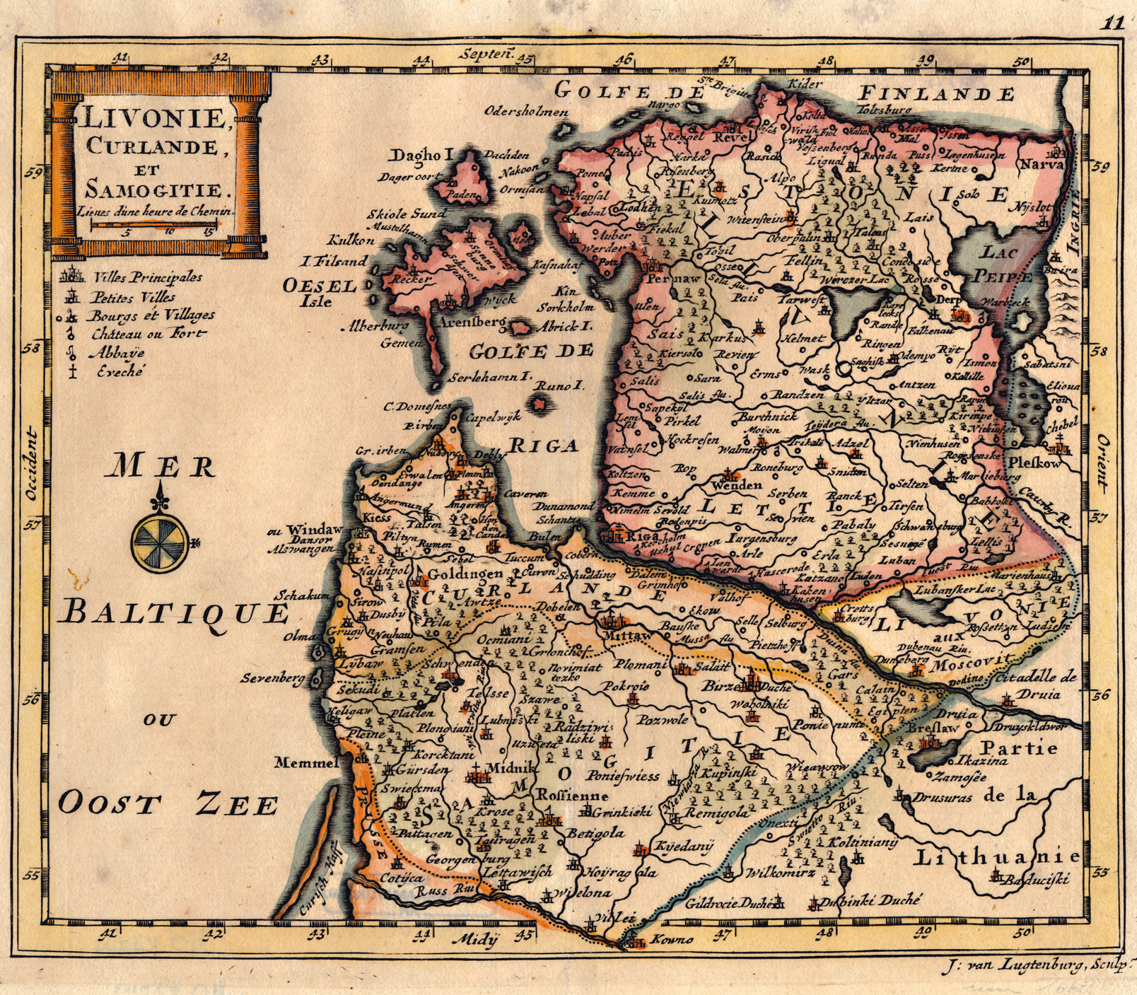
Livonie, Curlande et Samogitie |
||||
| Date | |||||
| Source | http://www.nlib.ee/html/digi/maps/Lugdenburg.jpg, original in the National Library Cartography Collection | ||||
| Author | J. van Lugtenburg Sculps | ||||
| Permission (Reusing this file) |
|
||||
File history
Click on a date/time to view the file as it appeared at that time.
| Date/Time | Thumbnail | Dimensions | User | Comment | |
|---|---|---|---|---|---|
| current | 05:21, 8 July 2008 | | 1,608 × 1,407 (3.03 MB) | Albert Krantz | {{Information |Description=? |Source=? |Author=? |Date= |Permission= |other_versions= }} {{ImageUpload|full}} |
File usage
The following pages on the English Wikipedia use this file (pages on other projects are not listed):