
File:Mount Hillers at the core of the Henry Mountains in Utah.jpg

Original file (6,595 × 2,673 pixels, file size: 2.57 MB, MIME type: image/jpeg)
| This is a file from the Wikimedia Commons. Information from its description page there is shown below. Commons is a freely licensed media file repository. You can help. |
Summary
| Description |
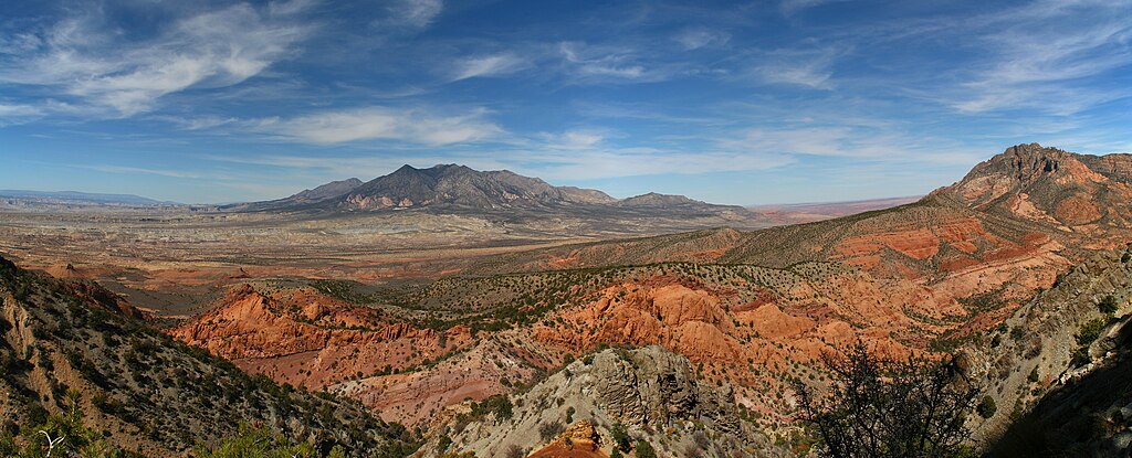
English: Mount Hillers at the core of the Henry Mountains in Utah.
In 1877 the USGS published a report "On the Geology of the Henry Mountains", on the small range of peaks in southern Utah. Up to that point, little scientific study had been made of the unassuming peaks, but the author of the report, one Grove Karl Gilbert, not only detailed the structure and mineralogy of the landscape, but in doing so also laid the foundations for much of modern geomorphology. While beautiful, the range is isolated and of limited economic value; Gilbert himself notably wrote that "No one but a geologist will ever profitably seek out the Henry Mountains", while the name given to the range by the Navajo is Dził Bizhiʼ Ádiní, literally meaning “mountain whose name is missing”. And yet, the wildness of the range is sufficient attraction for some - this is Mt Hillers, at the centre of the 5 peak range. Credit: Robert Emberson (distributed via imaggeo.egu.eu). |
| Date | |
| Source | https://imaggeo.egu.eu/view/13571/ |
| Author | Robert Emberson (https://imaggeo.egu.eu/user/remberson/) |
| Camera location | | View this and other nearby images on: OpenStreetMap |
|---|
Licensing
- You are free:
- to share – to copy, distribute and transmit the work
- to remix – to adapt the work
- Under the following conditions:
- attribution – You must give appropriate credit, provide a link to the license, and indicate if changes were made. You may do so in any reasonable manner, but not in any way that suggests the licensor endorses you or your use.
This file, which was originally posted to
https://imaggeo.egu.eu/view/13571/, was reviewed on 13 October 2018 by reviewer Leoboudv, who confirmed that it was available there under the stated license on that date.
|
| Annotations | This image is annotated: View the annotations at Commons |
File history
Click on a date/time to view the file as it appeared at that time.
| Date/Time | Thumbnail | Dimensions | User | Comment | |
|---|---|---|---|---|---|
| current | 21:55, 13 October 2018 | 6,595 × 2,673 (2.57 MB) | GeoWriter | User created page with UploadWizard |
File usage
Global file usage
The following other wikis use this file:
- Usage on arz.wikipedia.org
- Usage on ca.wikipedia.org
- Usage on ceb.wikipedia.org
- Usage on lld.wikipedia.org
- Usage on www.wikidata.org