
File:New Brighton Tower Map c1937.jpg

Size of this preview: 800 × 576 pixels. Other resolutions: 320 × 230 pixels | 640 × 461 pixels | 1,024 × 738 pixels | 1,280 × 922 pixels | 1,805 × 1,300 pixels.
Original file (1,805 × 1,300 pixels, file size: 1.06 MB, MIME type: image/jpeg)
| This is a file from the Wikimedia Commons. Information from its description page there is shown below. Commons is a freely licensed media file repository. You can help. |
Summary
| Description |
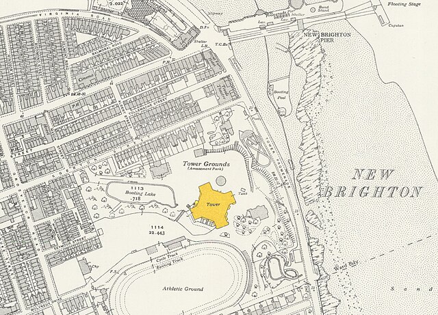
English: Location of New Brighton Tower on 1937 Ordnance Survey map |
| Date | |
| Source | National Library of Scotland, 1937 Ordnance Survey |
| Author | Ordnance Survey |
Licensing
This file is licensed under the Creative Commons Attribution 4.0 International license.
Attribution: Reproduced with the permission of the National Library of Scotland (copyright notice)
- You are free:
- to share – to copy, distribute and transmit the work
- to remix – to adapt the work
- Under the following conditions:
- attribution – You must give appropriate credit, provide a link to the license, and indicate if changes were made. You may do so in any reasonable manner, but not in any way that suggests the licensor endorses you or your use.
File history
Click on a date/time to view the file as it appeared at that time.
| Date/Time | Thumbnail | Dimensions | User | Comment | |
|---|---|---|---|---|---|
| current | 18:48, 14 March 2022 | | 1,805 × 1,300 (1.06 MB) | Bungle | Uploaded a work by Ordnance Survey from [https://maps.nls.uk/view/114581002 National Library of Scotland, 1937 Ordnance Survey] with UploadWizard |
File usage
The following pages on the English Wikipedia use this file (pages on other projects are not listed):
Global file usage
The following other wikis use this file:
- Usage on zh.wikipedia.org