
File:Reseau AL.png

Size of this preview: 412 × 600 pixels. Other resolutions: 165 × 240 pixels | 330 × 480 pixels | 886 × 1,290 pixels.
Original file (886 × 1,290 pixels, file size: 516 KB, MIME type: image/png)
| This is a file from the Wikimedia Commons. Information from its description page there is shown below. Commons is a freely licensed media file repository. You can help. |
Summary
| Description |
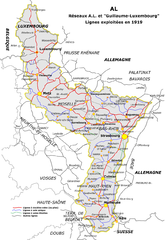
Français : Carte du réseau Alsace-Lorraine à sa création en 1919
Deutsch: Netz der elsaß-lothringischen Eisenbahnen nach dem Ersten Weltkrieg |
| Date | |
| Source | Own work |
| Author | PhilOmac |
| Permission (Reusing this file) |
Own work, all rights released (Public domain) |
Licensing

|
Permission is granted to copy, distribute and/or modify this document under the terms of the GNU Free Documentation License, Version 1.2 or any later version published by the Free Software Foundation; with no Invariant Sections, no Front-Cover Texts, and no Back-Cover Texts. A copy of the license is included in the section entitled GNU Free Documentation License. |
| This file is licensed under the Creative Commons Attribution-Share Alike 3.0 Unported license. | ||
| ||
| This licensing tag was added to this file as part of the GFDL licensing update. |
File history
Click on a date/time to view the file as it appeared at that time.
| Date/Time | Thumbnail | Dimensions | User | Comment | |
|---|---|---|---|---|---|
| current | 11:21, 11 January 2016 | | 886 × 1,290 (516 KB) | Niko67000 | ajout St Nabor |
| 11:12, 11 January 2016 |  | 886 × 1,290 (516 KB) | Niko67000 | ajout ligne de Rosheim à Saint-Nabor, CF forester d'Abreschviller | |
| 18:17, 29 October 2015 |  | 886 × 1,290 (514 KB) | Niko67000 | ajouts et compléments | |
| 21:05, 22 September 2014 |  | 886 × 1,290 (511 KB) | Niko67000 | ajouts et compléments | |
| 20:28, 7 March 2007 |  | 886 × 1,290 (491 KB) | PhilOmac~commonswiki | {{Information |Description= Carte du réseau Alsace-Lorraine à sa création en 1919 |Source= own work |Date= 29/11/2006 |Author= PhilOmac |Permission=Own work, all rights released (Public domain) |other_versions= }} |
File usage
The following pages on the English Wikipedia use this file (pages on other projects are not listed):
Global file usage
The following other wikis use this file:
- Usage on de.wikipedia.org
- Usage on fr.wikipedia.org
- Usage on ja.wikipedia.org
- Usage on lb.wikipedia.org
- Usage on www.wikidata.org