
File:St peter line route map.svg

Size of this PNG preview of this SVG file: 687 × 574 pixels. Other resolutions: 287 × 240 pixels | 575 × 480 pixels | 919 × 768 pixels | 1,226 × 1,024 pixels | 2,451 × 2,048 pixels.
Original file (SVG file, nominally 687 × 574 pixels, file size: 54 KB)
| This is a file from the Wikimedia Commons. Information from its description page there is shown below. Commons is a freely licensed media file repository. You can help. |
| Description |
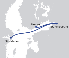
English: Route map of St.Peter Line |
||
| Date | |||
| Source | Own work based on: Location European nation states.svg by Ssolbergj | ||
| Author | Derivative work by Philphos | ||
| Other versions |
  |
||
| SVG development | This map was created with Adobe Illustrator, and with Inkscape.
|
I, the copyright holder of this work, hereby publish it under the following licenses:
| This file is licensed under the Creative Commons Attribution-Share Alike 3.0 Unported license. | ||
| ||
| This licensing tag was added to this file as part of the GFDL licensing update. |

|
Permission is granted to copy, distribute and/or modify this document under the terms of the GNU Free Documentation License, Version 1.2 or any later version published by the Free Software Foundation; with no Invariant Sections, no Front-Cover Texts, and no Back-Cover Texts. A copy of the license is included in the section entitled GNU Free Documentation License. |
You may select the license of your choice.
Original upload log
This image is a derivative work of the following images:
- File:Location European nation states.svg licensed with Cc-by-sa-3.0-migrated, GFDL
- 2010-10-09T15:55:16Z LX 2045x1720 (748293 Bytes) Reverted sockpuppet edits to version as of 15:03, 11 November 2009
- 2010-10-02T06:27:34Z Lartyo 2045x1720 (730891 Bytes) Reverted to version as of 20:37, 18 October 2009
- 2009-11-11T15:03:57Z NuclearVacuum 2045x1720 (748293 Bytes) minor
- 2009-11-11T14:59:54Z NuclearVacuum 2045x1720 (733426 Bytes) territorial fixes
- 2009-10-18T20:37:51Z NuclearVacuum 2045x1720 (730891 Bytes) several countries did not include all its territories
- 2008-12-04T00:44:42Z Ssolbergj 2045x1720 (726069 Bytes) Kosovo
- 2008-06-20T13:09:36Z Ssolbergj 2045x1720 (724181 Bytes) Reverted to version as of 00:57, 12 June 2008
- 2008-06-19T17:59:14Z Ssolbergj 2045x1720 (719110 Bytes) {{Information |Description= |Source= |Date= |Author= |Permission= |other_versions= }}
- 2008-06-12T00:57:39Z Ssolbergj 2045x1720 (724181 Bytes) {{Information |Description={{en|1=SVG map of Europe. Borders of nation states.}} {{no|1=SVG-kart over Europa. Nasjonstatlige grenser.}} |Source=[[:Image:Location Spain EU Europe 1.svg]] |Author=[[:en:User:Ssolbergj|Ssolbergj]
Uploaded with derivativeFX
File history
Click on a date/time to view the file as it appeared at that time.
| Date/Time | Thumbnail | Dimensions | User | Comment | |
|---|---|---|---|---|---|
| current | 12:18, 20 November 2011 | | 687 × 574 (54 KB) | Stefan2 | Replaced text: now storing real text instead of geometric shapes for letters. Also turned the city names into XML entities for easier translation of the image. |
| 19:23, 12 March 2011 |  | 687 × 574 (65 KB) | Joe200576 | resized | |
| 18:07, 12 March 2011 |  | 301 × 251 (63 KB) | Joe200576 | {{Information |Description={{en|1=Route map of St.Peter Line}} |Source=*File:Location_European_nation_states.svg |Date=2011-03-12 18:07 (UTC) |Author=*File:Location_European_nation_states.svg: Ssolbergj *derivative work: |
File usage
The following pages on the English Wikipedia use this file (pages on other projects are not listed):
Global file usage
The following other wikis use this file:
- Usage on et.wikipedia.org
- Usage on fr.wikipedia.org
- Usage on ru.wikipedia.org