
File:Talübergang Lavant August 2005.jpg

Size of this preview: 800 × 346 pixels. Other resolutions: 320 × 138 pixels | 640 × 277 pixels | 1,024 × 442 pixels | 1,280 × 553 pixels | 2,606 × 1,126 pixels.
Original file (2,606 × 1,126 pixels, file size: 1.96 MB, MIME type: image/jpeg)
| This is a file from the Wikimedia Commons. Information from its description page there is shown below. Commons is a freely licensed media file repository. You can help. |
Summary
| Description |
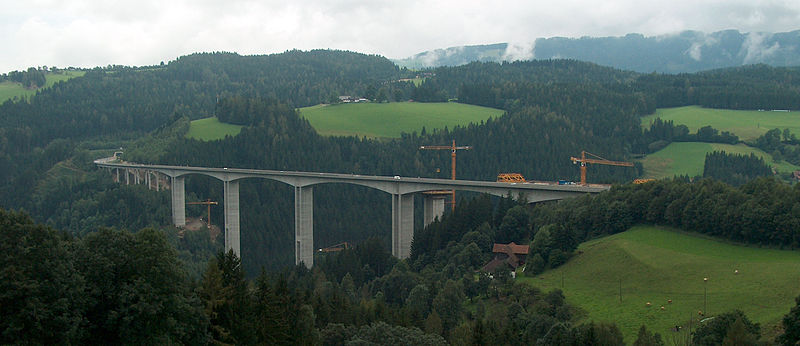
Deutsch: Dieses Bild zeigt den Talübergang Lavant, eine Autobahnbrücke in Kärnten, Österreich im Zuge der A2 Südautobahn während des Baus der zweiten Brücke.
|
| Date | |
| Source | Self-photographed |
| Author | newsflash |
| Permission (Reusing this file) |
Uploaded by the author |
| Camera location | | View this and other nearby images on: OpenStreetMap |
|---|
Licensing
|
The image is licensed under a triple license, please choose either of the three licenses below as desired. This file is licensed under the Creative Commons Attribution-Share Alike 2.0 Austria license.
 This file is licensed under the Creative Commons Attribution-Share Alike 3.0 Unported license.
|

File history
Click on a date/time to view the file as it appeared at that time.
| Date/Time | Thumbnail | Dimensions | User | Comment | |
|---|---|---|---|---|---|
| current | 09:04, 30 January 2006 | | 2,606 × 1,126 (1.96 MB) | Newsflash |
File usage
The following pages on the English Wikipedia use this file (pages on other projects are not listed):
Global file usage
The following other wikis use this file:
- Usage on ar.wikipedia.org
- Usage on cs.wikipedia.org
- Usage on da.wikipedia.org
- Usage on de.wikipedia.org
- Usage on et.wikipedia.org
- Usage on fr.wikipedia.org
- Usage on hu.wikipedia.org
- Usage on no.wikipedia.org
- Usage on ru.wikipedia.org
- Usage on sk.wikipedia.org
- Usage on sv.wikipedia.org
- Usage on uk.wikipedia.org