
File:Wfm nellis range redactions.jpg
Size of this preview: 800 × 593 pixels. Other resolutions: 320 × 237 pixels | 640 × 474 pixels | 1,024 × 758 pixels | 1,280 × 948 pixels.
Original file (1,280 × 948 pixels, file size: 128 KB, MIME type: image/jpeg)
| This is a file from the Wikimedia Commons. Information from its description page there is shown below. Commons is a freely licensed media file repository. You can help. |
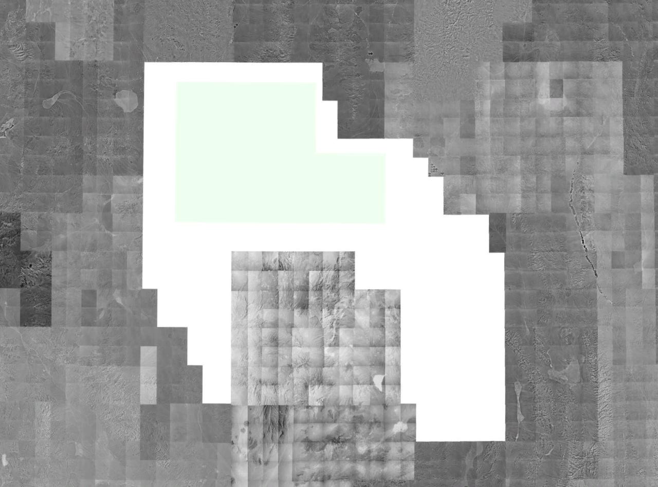
English: A montage image of southern Nevada, showing available USGS/NRO monochrome digital orthographic photography. Quads covering the Nellis Air Force Range (NAFR) are redacted from the photostream at source (and show up in this image in blank white). The Nevada Test Site (surrounded by the NAFR on three sides) is not redacted.
The verdant strip, (north-south) in the northeast is en:Pahranagat Valley.
The verdant strip, (north-south) in the northeast is en:Pahranagat Valley.
Source: USGS/NRO satellite photography, collected via NASA World Wind.
This image is in the public domain in the United States because it only contains materials that originally came from the United States Geological Survey, an agency of the United States Department of the Interior. For more information, see the official USGS copyright policy.
|
File history
Click on a date/time to view the file as it appeared at that time.
| Date/Time | Thumbnail | Dimensions | User | Comment | |
|---|---|---|---|---|---|
| current | 14:40, 21 June 2006 | | 1,280 × 948 (128 KB) | Finlay McWalter | A montage image of southern Nevada, showing available USGS/NRO monochrome digital orthographic photography. Quads covering the Nellis Air Force Range (NAFR) are redacted from the photostream at source (and show up in this image in blank white). The Neva |
File usage
The following pages on the English Wikipedia use this file (pages on other projects are not listed):
Global file usage
The following other wikis use this file:
- Usage on ar.wikipedia.org
- Usage on hi.wikipedia.org
- Usage on it.wikipedia.org
- Usage on kn.wikipedia.org
- Usage on ta.wikipedia.org