Almaty District
Almaty District Алматы Ауданы | |
|---|---|
 | |
| Coordinates: 51°9′N 71°30′E / 51.150°N 71.500°E | |
| Country | |
| Municipality | |
| Government | |
| • Akim | Maksat Samatuly[1] |
| Area | |
| • Total | 21,054 ha (52,026 acres) |
| Population (2014) | 375,938 |
| District number | 1 |
| Website | Official website |
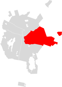
Almaty District (Kazakh: Алматы ауданы, Almaty audany; Russian: Район Алматы), is an administrative subdivision of the city of Astana, Kazakhstan. It was named after the city of Almaty.
Geography[edit]
Part of the mountainous Ile-Alatau National Park is in Almaty District.[2]
References[edit]
- ^ "Назначен аким района Алматы в Нур-Султане". forbes.kz. 2022-08-24.
- ^ "Ile-Alatau National Park (Almaty) - 2019 All You Need to Know BEFORE You Go (with Photos)". TripAdvisor. Retrieved 2019-04-19.
External links[edit]
- Official website (in Kazakh and Russian)

