Ebrahimabad-e Olya
Ebrahimabad-e Olya
Persian: ابراهيم آباد عليا | |
|---|---|
Village | |
| Coordinates: 36°24′55″N 55°43′28″E / 36.41528°N 55.72444°E[1] | |
| Country | Iran |
| Province | Semnan |
| County | Meyami |
| District | Central |
| Rural District | Meyami |
| Population (2016)[2] | |
| • Total | 1,284 |
| Time zone | UTC+3:30 (IRST) |
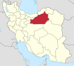
Ebrahimabad-e Olya (Persian: ابراهيم آباد عليا, also Romanized as Ebrāhīmābād-e ‘Olyā)[3] is a village in, and the capital of, Meyami Rural District of the Central District of Meyami County, Semnan province, Iran.[4] The rural district was previously administered from the city of Meyami.[5]
At the 2006 National Census, its population was 1,022 in 263 households, when it was in the former Meyami District of Shahrud County).[6] The following census in 2011 counted 1,276 people in 364 households.[7] The latest census in 2016 showed a population of 1,284 people in 409 households,[2] by which time the district had been separated from the county in the establishment of Meyami County.[8]
References[edit]
- ^ OpenStreetMap contributors (8 April 2024). "Ebrahimabad-e Olya, Meyami County" (Map). OpenStreetMap. Retrieved 8 April 2024.
- ^ a b "Census of the Islamic Republic of Iran, 1395 (2016)". AMAR (in Persian). The Statistical Center of Iran. p. 20. Archived from the original (Excel) on 17 November 2020. Retrieved 19 December 2022.
- ^ Iranian National Committee for Standardization of Geographical Names website (in Persian)
- ^ Habibi, Hassan (17 December 1379). "Creating divisional changes and reforms in Rudbar Rural District center, Kalat-e Hay-ye Gharbi Rural District center, and Meyami Rural District center". Lamtakam (in Persian). Ministry of Interior, Council of Ministers. Archived from the original on 2 January 2024. Retrieved 2 January 2024.
- ^ Mousavi, Mirhossein (25 August 1391). "Creation and establishment of 11 rural districts including villages, farms and places in Shahrud County under Semnan province". Islamic Parliament Research Center (in Persian). Ministry of Interior, Board of Ministers. Archived from the original on 15 November 2012. Retrieved 20 December 2023.
- ^ "Census of the Islamic Republic of Iran, 1385 (2006)". AMAR (in Persian). The Statistical Center of Iran. p. 20. Archived from the original (Excel) on 20 September 2011. Retrieved 25 September 2022.
- ^ "Census of the Islamic Republic of Iran, 1390 (2011)". Syracuse University (in Persian). The Statistical Center of Iran. p. 20. Archived from the original (Excel) on 20 January 2023. Retrieved 19 December 2022.
- ^ Rahimi, Mohammadreza (2 June 2013). "Letter of approval regarding country divisions in Semnan province". Islamic Parliament Research Council (in Persian). Ministry of Interior, Board of Ministers. Archived from the original on 25 September 2011. Retrieved 22 November 2023.


