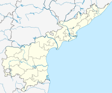
User:Bingobro/sandbox/Nagarjuna Sagar Airport
< User:Bingobro | sandbox
Nagarjuna Sagar Airport | |||||||||||
|---|---|---|---|---|---|---|---|---|---|---|---|
| Summary | |||||||||||
| Airport type | Public | ||||||||||
| Owner/Operator | Airport Authority of India[1] | ||||||||||
| Serves | Nagarjuna Sagar | ||||||||||
| Location | Nagarjuna Sagar, Andhra Pradesh | ||||||||||
| Time zone | Indian Standard Time (+5:30) | ||||||||||
| Coordinates | 16°32′33″N 079°19′07″E / 16.54250°N 79.31861°E | ||||||||||
| Map | |||||||||||
| Runways | |||||||||||
| |||||||||||
Nagarjuna Sagar Airport is an airport located in the state of Andhra Pradesh, India.[3] The airport is mainly used by private and chartered aircraft and has no scheduled services.[4] There are plans to upgrade the facility to enable scheduled commercial operations.[5][6]
References[edit]
- ^ https://www.aai.aero/en/node/72070
- ^ https://www.greatcirclemapper.net/en/airport/VONS-nagarjuna-sagar-airport.html
- ^ https://www.thenewsminute.com/article/andhra-may-develop-nagarjunasagar-airport-soon-land-availability-being-checked-60664
- ^ https://www.thehansindia.com/andhra-pradesh/nine-seat-flights-to-puttaparthi-nagarjuna-sagar-soon-521282
- ^ https://www.deccanchronicle.com/nation/current-affairs/200417/nagarjunasagar-may-get-a-new-airport.html
- ^ https://www.newindianexpress.com/states/telangana/2020/mar/19/aai-appoints-consultant-to-prepare-detailed-project-report-2118603.html
Category:Airports in Andhra Pradesh Category:Transport in Andhra Pradesh
Datia[edit]
Datia Airstrip | |
|---|---|
| Summary | |
| Airport type | Public |
| Owner/Operator | Airport Authority of India[1][2] |
| Serves | Datia |
| Location | Datia, Madhya Pradesh |
| Time zone | Indian Standard Time (+5:30) |
| Map | |
| Lua error in Module:Location_map at line 425: No value was provided for longitude. | |
Datia Airstrip is a small airstrip located in the state of Madhya Pradesh, India.[3] The airstrip does not have any scheduled services and is mainly used by private aircraft and air taxis.[4][5][6].There are plans to open a flight school at the airstrip.[7][8]
References[edit]
- ^ https://www.aai.aero/en/services/project-consultancy
- ^ https://centreforaviation.com/analysis/reports/aai-raise-funding-keep-pace-with-traffic-expansion-14-greenfield-airports-in-principle-approval-47682
- ^ https://www.windowtonews.com/news.php?id=71340&cat_id=8&p=365&search=
- ^ https://www.aai.aero/sites/default/files/LIST-UNSERVED-AS-ON22NOV16.pdf
- ^ https://www.patrika.com/datia-news/now-datia-will-start-air-service-1590895/
- ^ https://www.bhaskar.com/news/MP-GWA-HMU-air-service-will-also-start-from-datia-5647431-NOR.html
- ^ https://bansalnews.com/khabrein-gwalior-se/-pilot-academy-will-open-on-datia-airstrip/369385-144.html
- ^ https://bansalnews.com/khabrein-gwalior-se/-pilot-academy-will-open-on-datia-airstrip/369385-144.html


