
Harzhis
Harzhis
Հարժիս | |
|---|---|
 St. Minas Church in Harzhis | |
 Harzhis  Harzhis | |
| Coordinates: 39°26′00″N 46°13′18″E / 39.43333°N 46.22167°E | |
| Country | Armenia |
| Province | Syunik |
| Municipality | Tatev |
| Area | |
| • Total | 33.86 km2 (13.07 sq mi) |
| Population | |
| • Total | 879 |
| • Density | 26/km2 (67/sq mi) |
| Time zone | UTC+4 (AMT) |
| Harzhis at GEOnet Names Server | |
Harzhis (Armenian: Հարժիս) is a village in the Tatev Municipality of the Syunik Province in Armenia, 15 km southwest of Goris, on the left side of the Vorotan River, on the plateau. The distance from Kapan - the center of the province is about 79 km. The height above sea level is about 1700-1730 m.
Until 1968, the village was called Yaiji. With that name the settlement was included in the Zangezur uezd within the Elizavetpol Governorate of Russian Empire. During the Soviet years, Harzhis was a part of Goris region of the Armenian SSR. Since 1995, it has been part of the Syunik province of RA, since 2015 the settlement is a part of the enlarged Tatev Municipality.
Demographics[edit]
Population[edit]
According to the official census in 2011, the population of the village is 879,[2] down from 1,014 in 2010,[3] up from 831 at the 2001 census.[4]
Gallery[edit]
-
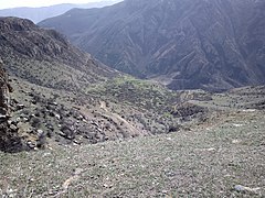 Scenery
 -
 WWII Monument
 -
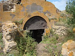 Kotrats caravanserai
 -
 Khatchkar from 1606 in Harzhis
 -
 Hin Harzhis
 -
 Kotrats caravanserai
 -
 13th-century Alan Tagavor church
 -
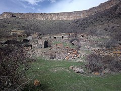 Hin Harzhis


.jpg)


.jpg)


References[edit]
- ^ "Syunik regional e-Governance System" (in Armenian). Syunik Province provincial government. Click on link entitled "Համայնքներ" (community) and search for the place by Armenian name.
- ^ a b Statistical Committee of Armenia. "The results of the 2011 Population Census of Armenia" (PDF).
- ^ "Marzes of Armenia and Yerevan City in Figures, 2010" (PDF). Statistical Committee of Armenia.
- ^ Report of the results of the 2001 Armenian Census, Statistical Committee of Armenia
