
Aghavnavank
Aghavnavank
Աղավնավանք | |
|---|---|
 A view of Aghavnavank | |
 Aghavnavank  Aghavnavank | |
| Coordinates: 40°43′51″N 45°05′36″E / 40.73083°N 45.09333°E | |
| Country | Armenia |
| Province | Tavush |
| Municipality | Dilijan |
| Elevation | 1,443 m (4,734 ft) |
| Population | |
| • Total | 337 |
| Time zone | UTC+4 (AMT) |
| Aghavnavank at GEOnet Names Server | |
Aghavnavank (Armenian: Աղավնավանք) is a village in the Dilijan Municipality of the Tavush Province in Armenia.
A hiking trail featuring the 12th/13th-century Aghavnavank Monastery, and a yew grove of the Dilijan National Park is located near the village.[2]
Notable people[edit]
Gallery[edit]
-
 Aghavnavank Yew Grove, Dilijan National Park
 -
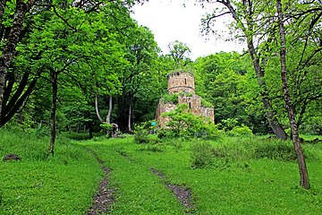 Aghavnavank Monastery
 -
 Scenery around Aghavnavank
 -
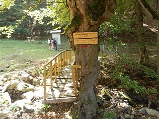 Dilijan National Park Hiking Trail
 -
 Aerial view of Aghavnavank Monastery


References[edit]
External links[edit]
Wikimedia Commons has media related to Aghavnavank.
Capital: Ijevan | ||
| Urban settlements |  | |
| Berd Municipality | ||
| Dilijan Municipality | ||
| Ijevan Municipality | ||
| Noyemberyan Municipality | ||
This article about a location in Tavush Province, Armenia is a stub. You can help Wikipedia by expanding it. |